Trough of LPA to bring rains over Visayas, parts of Mindanao
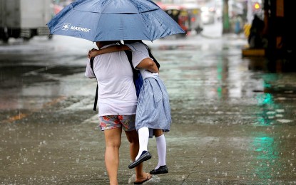

PROTECTED. Under a big umbrella and with her mother tightly carrying her, a young student will get home safe and dry amid a downpour on Sept. 12, 2023. The weather bureau on Thursday (Sept. 28, 2023) said the trough of a low pressure area, located 800 kilometers east of extreme Northern Luzon inside the Philippine Area of Responsibility, will bring rain showers over the Visayas and parts of Mindanao. (PNA photo by Joan Bondoc)
MANILA – The trough of a low pressure area (LPA) located 800 kilometers east of extreme Northern Luzon inside the Philippine Area of Responsibility (PAR) will bring rain showers over the Visayas and parts of Mindanao, the weather bureau said Thursday.
Scattered rain showers and thunderstorms are forecast over the Visayas, Zamboanga Peninsula, Northern Mindanao, Caraga and Davao Region. Flash floods or landslides are possible in these areas due to moderate to heavy rains.
“It is likely to dissipate within the day and unlikely to have a direct effect on any part of the country. However, its trough will bring rains over the Visayas and parts of Mindanao,” Philippine Atmospheric, Geophysical and Astronomical Services Administration (PAGASA) forecaster Patrick Del Mundo said.
Del Mundo said another LPA outside PAR is monitored, last tracked 1,850 km. east of southeastern Luzon.
“We don’t discount the possibility that the LPA outside PAR will develop into a tropical cyclone in the next (few) days,” he said.
Meanwhile, scattered rain showers and thunderstorms will also prevail over the northern portion of Palawan due to the southwest monsoon or “habagat”.
The rest of the country will have isolated rain showers caused by localized thunderstorms.
Light to moderate winds and slight to moderate seas continue to prevail across the country, PAGASA said. (PNA)