‘Habagat’ to dampen most of PH Friday
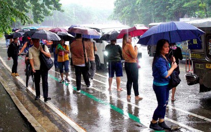
MANILA – Many areas in the country will continue to experience rains due to the southwest monsoon or the “habagat” enhanced by Severe Tropical Storm Hanna and the two tropical cyclones outside the Philippine Area of Responsibility, the weather bureau said Friday.
Hanna, last located 870 km. east of extreme Northern Luzon, is less likely to directly bring heavy rainfall and severe winds. It packs maximum sustained winds of 110 kph near the center and gustiness of up to 135 kph.
No tropical cyclone was hoisted on any part of the country, but the habagat will cause gusty conditions over Bataan, Aurora, Bulacan, Batanes, Ilocos and Cordillera regions, Zambales, Metro Manila, Calabarzon, Mimaropa, Bicol Region, Western Visayas and the northern portion of Eastern Visayas.
The habagat is also forecast to cause monsoon rains in Metro Manila, Zambales, Bataan and Occidental Mindoro, and occasional rains over the Ilocos Region, Calabarzon, Abra, Apayao, Benguet, Tarlac, Pampanga and Bulacan.
Scattered rain showers and thunderstorms due to the habagat will prevail over Batanes, Babuyan Islands, Antique, the rest of the Cordillera region, the rest of Central Luzon and the rest of Mimaropa.
Isolated rain showers caused by localized thunderstorms will continue to prevail over the rest of the country, the Philippine Atmospheric, Geophysical and Astronomical Services Administration (PAGASA) said.
Meanwhile, the enhanced habagat will continue to cause rough to very rough seas over most seaboards of Luzon and Western Visayas, and the seaboard of Northern Samar.
PAGASA said Hanna is expected to exit PAR on Sunday. (PNA)